FARO 3D Documentation Conference 2012
FARO 3D Documentation Conference 2012
February 21-22, 2012
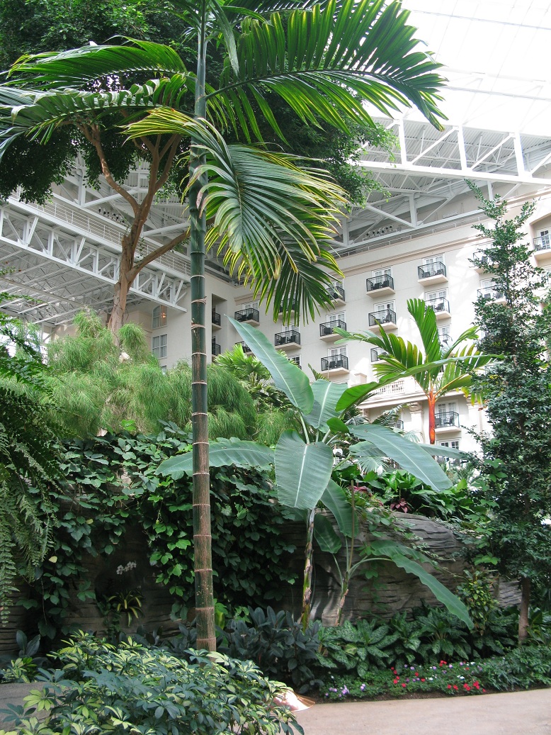
Gaylord Palms Resort and Convention Center, Orlando, FL

These were the first laser scanner conferences I have attended. I'm very glad I went to Orlando, my impressions have exceeded the expectations I had, from conferences and workshops to the site and diets. Special mention for me to have met two I was following on Twitter: Richard Lapointe of iSCAN 3d, and especially the Executive Director of CyArk, Tom Greaves, whom I hope to collaborate in the coming months. Then my my notes about this event:
INTRODUCTION
Faro Focus 3d:
easy to handle, color, 5h. of battery, simple use, touch screen, 1million points for
second, 120 metres, 10% noise, -60% price!
NOTHING
LIKE IT IN THE MARKET! Number 1 in LS!
Popular
science: top 100 best innovations 2011!
Surveying:
and many more. They want to make it available to all, democratization of software.
- Dr. Bernd Becker:
3d
documentation: have to be REAL!
Surveying
only captures a few points and also defines where things have to be! Skate out!
Accurate
of the images cares! Image matters!
Optical,
non tactile. Scan
points, color image, sensor data. Scans
image multisensor data...
Faro
flow: auto filter, color auto registration, auto homogenize, auto archive.
Only good
points:
1- foro
viz and analyse 3d mesure, web...
2- faro
interface: apps interface, cad exchg.
Efficient
data management matters!
Web based
information dissemination! Free!
Benefits: a lots!
All of us are
the pioneers!
- Vincent rossi: Twitter
@3d_Digi_Si - facebbok3d.si.edu, youtbue 3dsmithsonian Digi
3d
evangelism! 3d
workflows! 3d
spotlight projects!
Goal:
match industry adoption of 3d technologies!
Smithsomian
institution!
123d
catch to make quick 3d real models!
Mining
industry, engineering, hollywood!
Next
steps: cost down, accurate color capture along with geometry capture.
-
autodesk:
1- On one hand the reality
capture: huge motorways crossings. Problem: high cost. On the other hand: Xbox 360
camera laser, en iphone.... Low cost. opposite from the last one.
The
future is just now to start... With free software!
DEMOCRATIZATION!
2-Cloud
data.
3-Computing:
Bio computational evolution.
4-Simulation:
artificial simulation. Photorealistic rendering.
5-Digitlal
to analog: 50+ materials! Real models! 3d print! To very small to very
large! In context: bim + image= iphone app
All of
these points have to converge!
3d systems: Full
color, high definition. Affordable
digitalizing, cloud computing, 3d printing, mobile devices! Upload
and marke. Download
and customazice. Personalize. Individualize
everything. Customize
and accessorize! Home
printing and cloud printing!!!
Future:
Malers and garage entrepreneurs revolution, Gamers become creators, Content
capture covergence, (iphone can scan), digital paintings! Food creations!
Printed pottery!
Home of
the future. Mass individualization. Fertile startup environment!
Opportunity:
content to print simplicity!
- Marc Soicy from Polyworks:
Types of mesure equipments:
1- CMM, estatic table to mesure little pieces.
2-Laser arm, low point volume.
3-Laser
tracker... with receptor tool, manual laser and iphone.
4-Close
range point cloud digitizers. Manual scaner.
The best thing is to combine them. Multiple scans together.
For industrial works the best is Cloudworks.
- Tom Charron from Rapidform:
Important concept used continuously: "accurancy"
Very
limited support even for meshes.
Freeform
shapes.
New
method: point cloud to final product directly!
80% less time spent!
-Tom kurke fromm Geomagic:
Importance of copyright! The idea! "It will be awesome if they don't screwm it
up".
Care to scan an area with a sculpture copyrighted for example!
Buildings constructed after 1990 may have copyright!
Bridges do not have copyright, but some may be considered sculpture!
The
pavilions are protected artwork!
Pero no
nos asutemos, los escaneres no son considerados camaras fotograficas, por lo
tanto, podemos escanear lo que queramos, (x ahora)! En cuanto a arquitectura
solo!
Especially these rules apply in the USA.
For this reason, ALWAYS HAVE TO ASK! BE CLEAR TO WHOM IT BELONGS!
@TomKurke
-TOM GREAVES from CyArk- California:
3d documentation,,
what's next?
First CyArk conference in 2003. This company grow up to Europe.
3d
imaging-3solved problems
Magic box
to look trough the walls. Real time 3d image.
Opto-mechanical
architecture
How do we
map indoors? Automatic way, university of california.
How do we
get true 3d video? Ex. Improve the crasher software accidents.
Why
heritage documentation?
I the
media, national geographic, archaeology, domus.... Etc
Digital
preservation, archiving, k12 education, cultural tourism, management tools,
documentation for conservation, field data collection.
MOUNT
RUSHMORE
Ben Kacyra: Ancient wonders captured in 3D, Scotland:
http://www.ted.com/talks/ben_kacyra_ancient_wonders_captured_in_3d.html
machinima.com ubisoft
Tikal!!!
Mayah pyramid
-Eric hoffman: the role of laser
scanning in corpotate decision making
The
origins of 3d environment perception. 1982, 83, 84...
-Michael
Raphael:
DIRECT DIMENSIONS, industrial, architecture, landscape, cars.. everything.
17 years
in the business. Over 25
years in 3d reality capture.
Stereo
photogrammetry 3d software.
Kinect:
in-home 3d imaging for xbox 360
WebGL/
123d catch/ market bot / shaperways / cubity / tinker cad
Columbia
university scanning: building 3d surfaces.
Valley
force riverbank
Lyric
opera house: 10 min of 1 unic scan and you get everything!
F5
overview hand size, to scan in real time as you walk. Example, linear concrete beam and tubing. Maryland 9/11 memorial, concrete disaster scanned piece.
Shapeshot, to scan faces. Example, Star Wars princess face.
-Ken Smerz: laser scanning in the
a/e/c PRECISION 3d
Speed
& Accurancy
Penn
state BIM project
Vi-com
element!
Suggested
Workflow concept!
Case
study laser scanning during construction!!! Ex. airport... Served for the architect and the contractor in charge of the covers and roof. They sack the deviation between the project and the actual model. Surface analysis, triangulated irregular
network, TIN. (Similar of John Smits colour layers).
Market
implementation tommorow! So big!!!
-Paul Tice: i-Ten / Prerservation
the past, sustaining the future 3d infrastucture doc.
"History
of visualization.avi"
Engineers,
architects, archeologists, animators, historians and marketing firms too!
Te dream
project: Minimal time, max quality, impeccable accuracy!
A smart
approach. Our investment. Troubleshooting. Rendering.Other projects,
(photogrametry...)... Learning curve $$$$$
What we had?
Registered point cluds, a point cloud view.
Preserving
the past: digital, adaptative reuse, photorealistic visual.
Sustaining
the future.
COMBINATION:
tradicional drawings, CAD, precision 3d models, FARO+CAD!
WORKFLOW:
field, scan, animation & modeling/rendering
Low-resolutiono/density
walk-throught, verify, editing, re-processing, visualization, etc.
Workflow
ROI ---- SUCCESS
-ex1.
evergreen wings and waves waterpark 2days
-ex2. USS
blueback submarine 2days
Special mention the video: "The art
of scanning.avi"
-Tracey: NASA, Chief
Scanning,
modeling and simulations.
Mensi
s10: range 10 meters, rate 100 pps.
Mensi
s25: Colombian digital reconstruction 2003.
Atos II:
precision optical scanning 2004
Mensi
GS200: time-of-..
Mensi GX
& S6: facility scanning with a survey workflow using total station. Range
550 meters.
Faro
LS880: phase shift facility/equipment scanning
Faro
focus 3d: rapid and high volumen 3d doc using 3d focus. 120 m. 976000 pps.
Surphaser
IR-x / leica AT407: 30 m. 1200000pps laser 160 m. Waterproof
Data
collection: leica / processing: faro / modeling and simulation: delmia, catia!
Process
scan data concurrently with data colection at job.
Site, do not "over
scans"... less scans... less data!
Software:
Tuberias industriales.
Dissecting
the 3d laser scan point cloud blob!
-Faraz Ravi from Bentley:
Point
clouds are game changing.
ProjectWise
point cloud service.
Bentley
geo web publisher.
Bentley
navigator for ipad!!!!
-John Smits: Promoting
laser scanning to the A/E/C industry. (My Sponsor)
Point Cloud data can
be used to create as-built base drawings for Architectural renovations and
restorations.
Scans need to be
taken at each level from the scaffold.
Align all levels and
trim away the scaffold data, leaving behind the cupola.
The resulting point
cloud data can be used to create a series of details.
Slices can be used to
accurately define the radius and curves of the panels.
Scanning from
multiple stations provides base data for the model.
Completed Revit model ready for
Engineers use.
Documentation &
Surface Mapping:
Point Cloud data
enables basic CAD facades to be drawn to scale.
This mapping can be
applied to all walls, indicating the problem areas for closer study.
The mapping shows
overall tilt of façade as well as areas that have moved at a different interval
Mapping for Solid
Model Shop Drawings:
When presented with a
complex shaped poured concrete form, establishing the amount of surface
deviation allows for proper attachment detailing of curtain wall installations.
Use the data to
create a 3D model within CAD.
Design &
Preconstruction Documentation:
BIM, Revit Models, Mapping
for Floor Leveling

WORKSHOPS:
No. 1 : Architecture:
- Students: "An independent Research study of the University of Central Florida Architecture division in conjuntion with the city of Orlando". "The virtual Orlando project".
- Franklin Sebastian, Architect: Example of a 3d laser scanner project using Revit.
No. 2: Heritage Preservation:
- University of South Florida, USF / Advanced Visualization Center / AIST:
Depends on the product we want, we will choose the definition. What are we looking for? gometria, detail, or texture?
Example 1: They used TLS to document the Actium War Monument in Greece.
Example 2: Improve Models of Volcano Conduit Processes.
Example 3: Reconstruction of human skulls.
Example 4: Florida Caverns National Register Site. Crack. Two days.
Example 5: Takalik Abaj, Guatemala. Archaeological project, multiple scanners, GPS surveys, imaging techniques, etc. Surveys are inserting into google earth. Computer modeling. They use techniques to see by color the different heights, like John Smits.
Visualizatin = discovery
Future: New ways to teach!
Software they use: Scene, Kubit, AutoCAD, ArcGIS, Terramodel, Maya 3D, Pointools, Geomagic, Sketchup, Z-Brush.
- Bernard Frischer Consulting, INC: Research on sculpture
Book "Colin Ware's anaylisis of power visualization.
Example 1: Augustus of Prima Porta, (Museo Vaticano). "The digital Sculpture project" WEB. recreation polychromatic.
Example 2: Pan-Nymph in the Dresden State Museums. Virtual reconstruction of the initial state. Experiments otherwise impossible. Relationship of cast and original statue.
Example 3: "Laocoon" (Museo Vaticano) Arms reconstruction.
Virtual World Heritage Laboratory.
Example 4: Test of "Franceschini-Veneziano thesis. (NSF grant # 11S-1018512). Hadrian's Villa, near Tivoli, Italy. Book: "Villa Adriana, architettura celeste" (i segreti dei solstizi). Isis's statue, 3d model and virtual relocation in the village.
Example 5: charlottes villa, Virginia.
Seymour TM: Point clouds models within HTML. Full model is never downloaded, only PNG view, (securiy).
You can upload your own models in the web site. (.ply format).

No. 3: Architecture:
- Jonathan Coco: ENGENSUS mesuments.
Idea 1: Pointcloud Rendering & Creating Thermal PC:
Idea: Keep the cloud of points with high quality, not to create 3d model. Export ".pod" format from Scene into Microstation.
Luxology: ignore open elements and text -off. Render geometry outside view -off. Click right the first two option. (x=1000/y=552)
Lighting - ligher manager - place light.
Idea 2: Creating thermal pointclouds:
High reolution: L.S. IR - 710 MPix.
S. camera - 3MPix.
IR camera - 0,1 MPix.
If we combine both, we will get higher quality product.
Add thermal information to L.S.
Increase thermal image rsolution.
Doble confirmation of deformations due to temperature changes.
Tracking of many IR capture in 3d environment.
Faro Scene to combine the pointcloud with thermal picture. Then colorated and aligned.
Conclusion: You can see the overheated areas, areas without heating. This way you can know how much money is wasted on heating, etc..
Next step: Render thermal pointclouds???
- John Smits: Documentating Rusticate Surface Variations
Example 1: High Bridge, NYC. Is better to work in parts the scanning. Then be aligned in CAD=UCS. Multipleslices (3 inch each).
Documenting curved
forms with rusticated surfaces can be easily accomplished using multiple point
cloud scans.
Once aligned, the
individual scans can be used to export data to CAD.
Using multiple slices
at different elevations, create a layered plan view in CAD.
Returning to the
drawing for the vault, begin to take slices to document the surface variations
formed by the cracks.
By
colorizing the various slices, changes over a set dimension within the vault
are documented
The variations in
masonry movement can be dimensioned in CAD.
Example 2: Facade Surface Desviatioons. Be careful, consider the face of the wall, we can mistake and take the interior of the wall. Slices 1/2 inches.
Once imported into
CAD, confirm orientation and view.
Select scan showing
portion of façade to be studied.
Once aligned, go back
to façade view with all points shown. Now we need to take a vertical slice.
This slice now needs
to be turned 90 degrees to show vertical
alignment of the wall.
This thin vertical
section can be compared to vertical lines for deviations from a 90 degree plane
off horizontal.
Start line at top or
bottom, in alignment with the points.
Offsets from the
drawn line to face of the masonry can be indicated by dimensions within CAD.
Once a baseline is
established, begin to create sections across the face of the wall. Select a
thickness for the sections.
Bring back all
points, then select area between two lines for a vertical section/slice.
Take slice, then
return to front façade view.
Save
section taken, alter color so it stands out from other points
Eliminate view of all
points, and proceed to cut sections into face of wall. Save and colorize each
one.
Once completed, open
all sections to reveal colorized topographic map of the wall.
Close up view of the
data reveals the rusticated face of the wall surface, while the colors indicate
a measurement of its outward tilt.
We can export in .jpg pr .png format.
Rapidform to create base line: CAD line.

My sponsor John Smits in the Architecture Workshop
Gaylord Palms Resort and Convention Center:


Related Articles:
- Tom Kurke to Bring IP Issues in Digital Documentation into FOCUS at the Faro 3D Documentation Conference:
http://geomagic.com/en/community/beyond-the-box/tom-kurke-to-bring-ip-issues-in-digital-documentation-into-focus/
- FARO CEO declares: We’re #1:
http://www.sparpointgroup.com/FARO-CEO-Number-1.aspx
- Over 270 Attend First Faro 3D Documentation Conference:
http://blog.lidarnews.com/over-270-attend-first-faro-3d-documentation-conference
- AVEVA and LFM sponsor and exhibit at the FARO 3D Documentation Conference:
http://www.maritimeandenergy.com/news-international/2012/02/aveva-and-lfm-sponsor-and-exhibit-at-the-faro-3d-documentation-conference
- Can You Work in 3D? :
http://geodatapoint.com/articles/view/can_you_work_in_3d
- Head in the Point Clouds:
http://www.sparpointgroup.com/Blogs/Head-in-the-Point-Clouds/Odds-and-ends-from-the-first-FARO-show/

Comments
Post a Comment