SPAR International Conference 2012
SPAR International Conference
April 15-18, 2012
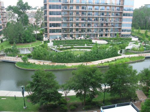
The Woodlands Waterway Marriot Hotel & Convention Center
The Woodlands, Houston, (Texas)
The woodlands:
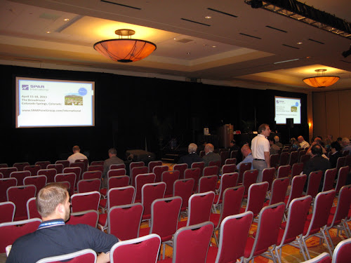
Wednesday, April 18
9:00-10:15
3D Learnings In Schools
Bio
Lourdes García Cerezuela
Polytechnic University of Valencia, Spain
 Young Spanish Architect specializing in Heritage Preservation using 3d laser scanning. Has worked and studied around the world. Began work studying traditional Spanish architecture with office of "Mileto & Vegas". Joined an archeological expedition to the Euphrates valley in Syria then continued as freemover in United Kingdom. Moved to Venice working with "Torsello Architettura", was sent to the Lori province of Armenia to document a monastery. Currently interning with a NYC based architect and laser scan company.
 Abstract
"Using Scanner for Documentation of Buildings, Old & New"
Topographical Survey of the pavement of the square of the Church in a town of Teruel, Spain. Graphic and metric survey, previous study and 3d model of Sanahin's Monastery, Armenia. 3d model of the Manhattan's Gatehouse for Highbridge, New York City. Scanning the interior of the Citigroup building in NYC to identify clash detection.
QR Code:

MONDAY 16 April
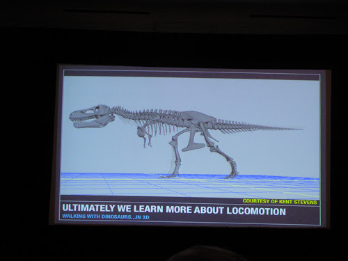
- Dr. Phil Manning, Head of Palaeontology Research Group, University of Manchester (UK):
"Dinosaurs Space Shuttles and Synchrotrons"
Big bones.... But no roads.
Locomotion
What colour were dinosaurs? A pigment of our imagination.
Can fosils teaching something new?
X-rays soace shuttles agited electrons... Bright light.
Fluorescencd x-ray: unique set, powerful nondestructive tool for studying fossils.
Better knowledge colour for artists.
Next? 3d chemestry = tomography: k-edge substraction
Simplification software!
Www.dinosaursabbatical.blogspot.com

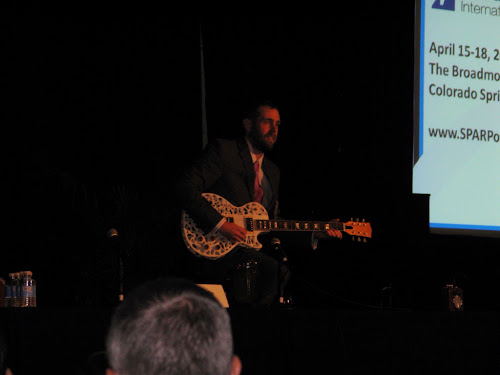
...in the meantime... Sam Pfeifle playing a electric guitar build with 3d print technology...
- Abe N. Reichental, President & CEO, 3D Systems CorporationDisruptive > Tranform > impactMassive individualizationMake ir real
Inspiring educationHeriatge preservation & democratization !
Gestural salpingDigital food creations
Printed pottery
Makers revolution
Digital fashion ( printed full colour)
Construction > creativity
Capture converge3d print cheaper than ink!Abe.reichental@3dsystems.com


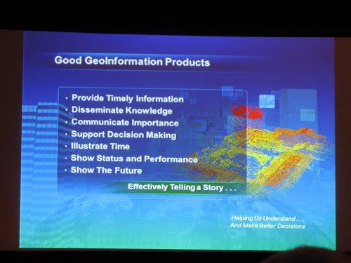
- Lawrie Jordan, Director of Imagery, Esri
Many forcesvare converging.
Cloud computing: software, platform, infrastructure.
Imagery > landsat service
Lidar: 3d visualization and analysis / data
Voluntered geographical information (VGI)
Social media mapping
GIS is advancing into 3d: adding 3d content generation and 3d design tools.
Creation city 3d on time, changing, editong with just a "clic"
Malla low resolution with a high number of images
3d artificial coty of the future!


PHOTOGRAMMETRY:

- Eugene Liscio, P.Eng:
1492: Da Vinci > optical projection
1592: Albrecht Duerer > laws perspective 1525
ERAS:
1850-1900: plane table photogrammetry
1849: Aimé Laussedat: terrestrial photogr. > topogr.
1900-1960: Analytical photogrammetry
1980-now: digital photoframmetry
1980-1990's: points and lines
Was manual.
Software: photomodeler, elcovision, rollei metric, photoscan... 123 catch
Coded targets
2005: dense stereo reconstruction. Dense reconstruction were possible
Scale invariant feature transformarion: object recognition from local scale-I-F
Silt - feature detection & marching
2006: intergeo > PMASG
2008: fully automated photogrammetry: bundler, photosynth, Photofly

-Forensics:
Microscopic imaging
Fingerprint unwrapping
Anthropology
Footprint doe ( 90 degree pictures: NO)
Tire tread and patterned evidence
Roadway defects/documentation
Clandestine grave
Suspect height
Bullet trajectory doe
Vehicle modeling
Crime scene modeling
UAV
-ADVANTAGES:
Most underutilized tools in forensics
Almost everyone has a digital camera
Flexible technology
Scalable to objects large and small
Low investment ( software and training)
Easy to use
-Regenerating point cloud from photogrammetry:
More noise
Color
More density
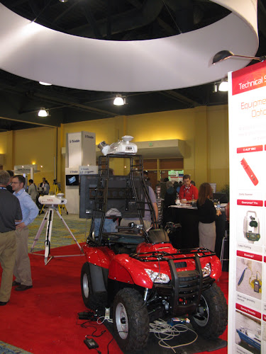
- David Boardman, urban robotics ventures:
Rapid 3dmprocessing of massive sensir database:
<24 hoursmdaily operation.
Extract 3d out of 2d images.
Computer vision and information
Ex.1: Himalayas: 100.000+ images
Ex.2: Mt. moods: 10.000 images
Ex. Salmon Creek Dam: 459 scans / 50 millions point cloud.
Ex.3: EPFL University campus: 800 + just point cloud. Different high buildings .
Office plant: 44 iphone images
- Carlos Velázquez, Ceo Epic Scan LTD:
volumen calculations analysis.
Collection strategies: Trimble Geo XT 2008, terrestrial lidar leica c10, photogrammetry
Resulting point cloud photogrammetry

Exhibits:


Ken Smerz, (Precision 3D Scanning) & John Smits (Actus3d)


University of Florida


Band!
Hand Scanner of FARO - Demostration
NYC Team!
TUESDAY 17 April
- JohnBattaglia:
Monitoringsurface definition by combaning total station and laser scannning.
Feasibilityof reliable target dual use.


- JohnSmits: "Selling scanning to the design and contruction industry"

Examples: Ritz Hotel, San Peter's ChurchNJ, Manhattan Gatehouse cracking, Museumcooper Hewitt Manhattan, Hand scanner ("a mesh will be a mesh"), Fordham Church University (The Bronx), BIM, Model the floors and te walls up & down (topographic layers), Bridge/Pier NJ.


Conclusion:
"Allthe projects you have been contracted for by clients. They were all completedwithin 1-3weeks, some within 2 days. Most importantly they provided a valuedservice to the client. This is the bread and better within the AEC industry.
Laserscanner is so much more than just as is documentation. Its about providing yourclients information: accurate, precise information within a quick time frame ina format that allows them to add real value to their services."

-Jan Vansickle:
Ex.1:mount home Idaho:
pointcloud and 3d model in google maps, like a viewer.
Clientjust with one clich know everything from the database.


-Hirofumi Ebi:
1st part:
Fieldinvest.
Planmodif. Plan
Planmodif. Design
Planmodif. Drawing
Fieldwork management
Photogrammetry


2nd part:
Whitesufaces work better with scanners...


(Unfortunately we don't know which is each one)

AFTER DISASTERS:

- Dr.Robert Kayen:
rieglscanners
Organizedteam and leadership: productivity and safety.
Leades tocollect and organize observations into digital mapped database.
Follows.
Cultureof safety!
AdvantagesRiegl:
-portable,rapid and eye-safety.
-lab-basedgeometry analysis of landscape.
-permanentdata archive
Usingwhiteboards and photos to document scans and reflectors, (date, location,name...).
"ShirakawaVillage Landslide, Fukushimq 4/2011"
Non-disasterswe always carefully fix-mount and we use..... Pict
Analysisis done in the lab., not the field!
www.geerassociation.org
M9 TohokuEarthquake, Japan


- Jody J.Lounsbury, PLS:
Lidaradvantages: survey, design and construction expedited to dateinteroperability...
Providedthe link between photographic evidence and real world elevations.


- MichaelOlsen: oreges St. university


- ShuheiHatake:
Tohokyearthquake and sunami

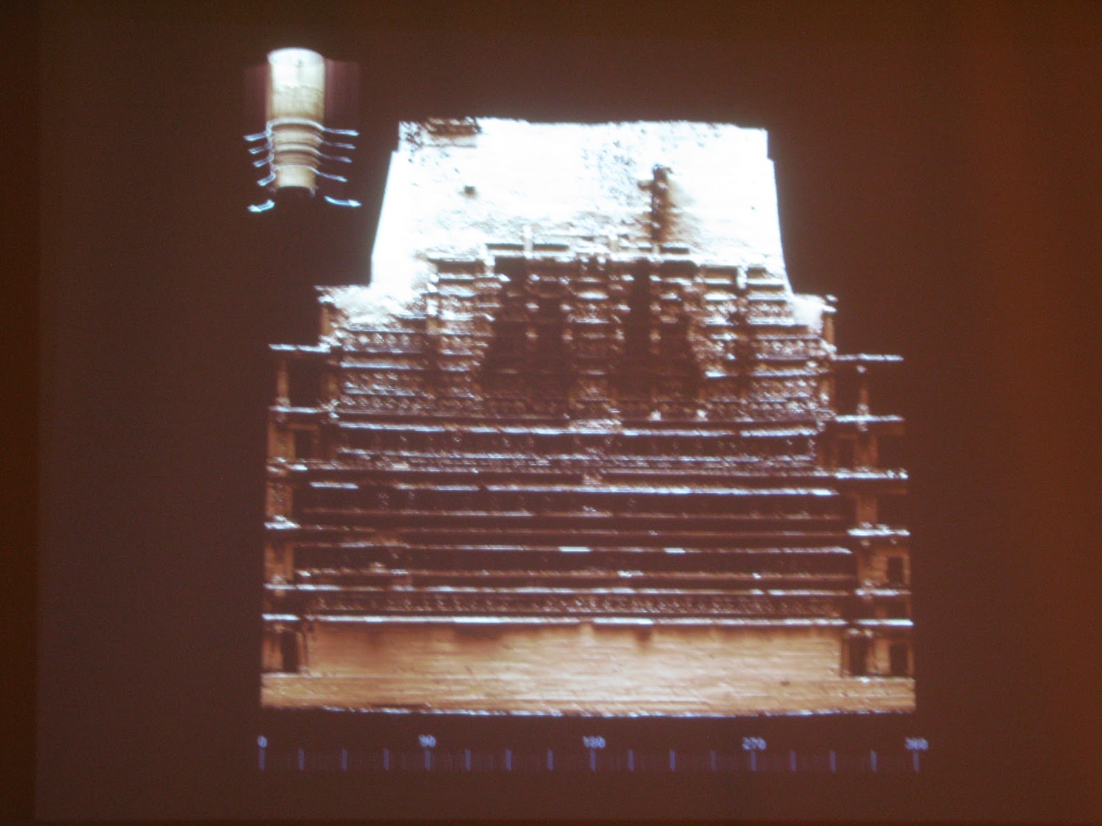
DIGITALHISTORIC PRESERVATION
- ChrisMcGregor: TheScottishTen: A project update
"GlasgowSchool of Art"
CyArk:500 challenge

CDDVProject showcase
Ex.1:Stirling Castle: 2 years
Laserscanner and hand scanner
Ex.2:Rosslyn Chapel:
studiowork
App readysoon...
new Lanar
Neolithicorkney
St. Kilda
Edimburgh
Autoninewall
MountRushmore, Quing Tombs, Rank-ki-Vav
10projects
1-edimburg: 2'5 years, full city, texture and enviroment
2- MountRushmore Nacional Memory: texture but no animation


3-Rani-ki-Vav:

- Chris Mealy:
Ex.1:music Hall documentation:
Generalfield survey 2004
Awardcontract 2009
Handmeasument
Slopingsurfaces
Complexsurfaces
Caddrawings


Revitmodel
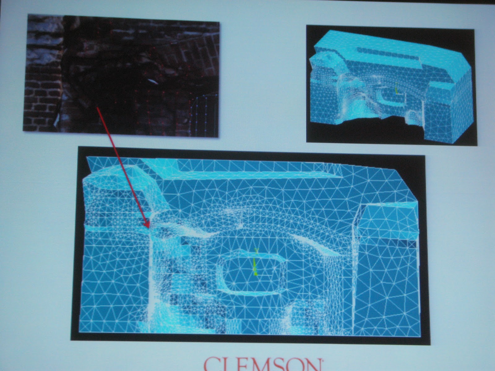
-Benjamin Rennison:
Photogrammetry
Ex.1:Fort Sumter Nacional Monument
Clemson University
Stolemeasuments tasks
Establishingcontril and monitoring points
3d highresolution model.
5primarycontrol points!
Monitoringpoints for photogrammetry
"TrimbleCx scanner"
Ohitogrammetrywith 123catch
brennis@clemson.edu


- BoraSayin, SolvoTek: Instambul
Ex.1:Prikitch, east Turkish
CyArk dothe panoramas and animations.
3d meshmodel to do the orthophotos,
solvoTek'sArcheological software for virtual restoration.


- My Exhibit:


- Others exhibits:


My presentation:


Houston industry

Blue Crisps in JetBlue flights!

Arrival to NYC
Specialmention of Spar 2012 speakers:
- NewTechnologies, open Source 3D: 3d pointcloud processing using open source forfiltering, aturenestimation, surface reconstruction, model fitting &segmentation. ( RaduRusu, Point Cloud Library / Geoff Peters, Urban Robotics / Ken Spratlin,Trimble, Geomatics / Joseph Djugash, Toyota.
- Chris Tisdel (Director of Global Enterprise Solutions, Gehry Technologies)
- NEW TECHNOLOGIES(3): Portable Data Capture Demos: Backpacks and other portable technologies, demonstrations and presentations. (Avideh Zakhor, UC Berkeley; and John Russo, ARC (USA); Andrew Baddeley, NCTech (Scotland); Christian Hesse, Hesse and Partner Engineers (Germany); Elliot Duff and Mike Bosse, Autonomous Systems Lab, CSIRO ICT Centre (Australia).
- Hirofumi Ebi
Specialmention of new contacts:
- DavisS. Mitchell: Director of Conservation / Historic Scotland
- TomGreaves: Executive Director / CyArk
-Chris McGregor: ScottishTen- Douglas Pritchard: GlasgowSchool of Art
- Alan L.DeMann: Business Development Manager / Nolte Vertical Five
- JamesAllphin: Account Manager / Quantapoint
- Dr.Mohammed S.Alfarhan: Oil andGas Research Institute
- Dr.Bernd-Dietmar Becker: Director of Product Management & Business Development3D-Laser-Scanner / FARO Europe
- Ken Smerz: President of Precision 3D Scanning
- Roger Rovira: IKERD Consulting, LLC
Specialmention Exhibits:
- Z+F: Zoller+Fröhlich
- Viametrics- Acute 3d
- Laser scanning America
- NC Tech Ltd.
- FARO
My interview:
http://www.youtube.com/watch?v=9hZ72-LUCjo
Bibliografía / References:
- http://www.sparpointgroup.com/SPAR-International-2012-Lourdes-Garcia-Cerezuela/
- http://www.sparpointgroup.com/SPAR-International-2012-Online-Poster-Session-PUVS/
-Sam Pfeifle youtube videos:
http://www.youtube.com/watch?v=vKuPRKTPeCo&feature=relmfu
http://www.youtube.com/watch?v=Li8rp6kc3lo
http://www.youtube.com/watch?v=lHWsBICrCoE

Comments
Post a Comment